Support OpenDurham.org
Preserve Durham's History with a Donation to Open Durham Today!
OpenDurham.org is dedicated to preserving and sharing the rich history of our community. Run by our parent nonprofit, Preservation Durham, the site requires routine maintenance and upgrades. We do not ask for support often (and you can check the box to "hide this message" in the future), but today, we're asking you to chip in with a donation toward annual maintenance of the site. Your support allows us to maintain this valuable resource, expand our archives, and keep the history of Durham accessible to everyone.
Every contribution, big or small, makes a difference and makes you a member of Preservation Durham. Help us keep Durham's history alive for future generations.
Comments
Submitted by David Southern (not verified) on Wed, 5/9/2012 - 12:45pm
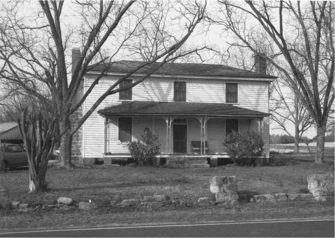
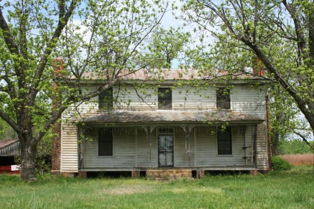
Fendol [note spelling] Bevers (1822 - 1883) was a farmer and surveyor, and his excellent 1871 map of Wake County may be accessed on the NC maps site.
http://dc.lib.unc.edu/cdm4/item_viewer.php?CISOROOT=/ncmaps&CISOPTR=241…
During the period 1870 - 1895, many NC counties ordered maps designed specifically to demonstrate the new township borders that had been created under the 1868 Constitution. Farmsteads and other locators are shown within these township boundaries. When Bevers made his map, Durham County did not yet exist, and his farm and home on the Leesville Road would then have been well within the bounds of Wake County. He is buried in the Andrews Chapel cemetery, and his tombstone is shown on Allen Dew's NC Cemeteries site.
http://cemeterycensus.com/nc/durh/cem001.htm
It would be a mighty shame to lose this lovely old place and its important associations.
Submitted by Patricia Stone… (not verified) on Fri, 10/3/2014 - 3:24pm
In reply to Fendol [note spelling] Bevers by David Southern (not verified)
I totally agree that it would be a shame to lose this wonderful home. As a great, great granddaughter of Mr. Bevers, I would like to thank Preservation Durham and all others who have worked diligently to share the history of this important residence. I'll be watching with interest to see what happens to it, and do hope that someone with the land and means to care for it will come forward.
Submitted by Rob Langlois on Sun, 11/26/2017 - 10:24am
The house is gone. I took a picture of the house number on the post at the road. Same as the one in Bing maps street level.

Add new comment
Log in or register to post comments.