Burch Avenue

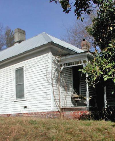
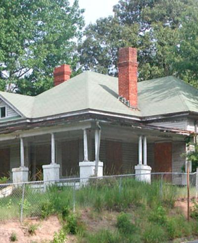
The Burch Avenue [Neighborhood] developed as a response to Durham’s burgeoning population at the turn of the twentieth century. It is part of Durham’s historic West End, once literally the west end of the town in the early twentieth century, which extended from Willard Street west to Swan Street and from Main Street south to Morehead Avenue. West End bordered on the Morehead Hill Historic District, a prominent white neighborhood to the southeast. The Burch Avenue area of West End was occupied predominantly by working- and middle-class whites. However, portions of West End south of Chapel Hill Street where the terrain was more uneven, including Lyon Park south of Morehead Avenue, were occupied by African Americans, as were the northern fringes of the neighborhood near the railroad tracks and, more recently, the Durham Freeway.

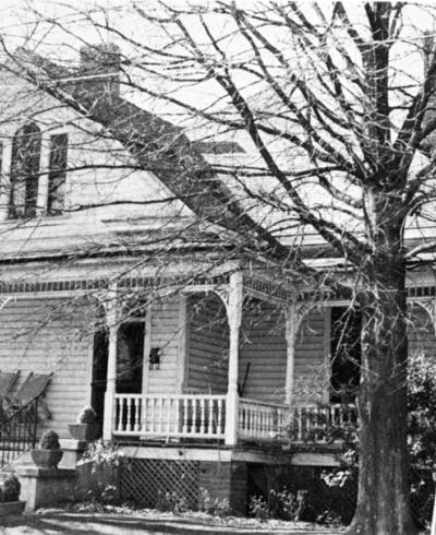
The east end of the district between S. Buchanan Boulevard and Gattis Street was platted in the 1880s and 1890s and includes the property of Charles Watkins and J. W. Gattis. The Watkins property, platted in 1888, contained approximately thirty-three parcels and was bounded by Buchanan Boulevard (formerly Milton Avenue), Burch Avenue, Gattis Street, and Rome Avenue (formerly Spring Street). Five of the parcels are labeled, including lots for “Wilkerson,” E. J. Long, and W. B. Davis, indicating that their homes may have already been located on those parcels; however, none of these early houses remain. Constructed around 1890, the only remaining structure from this period is the William Thomas O’Brien House on Wilkerson Avenue. O’Brien was instrumental in the tobacco industry, arriving in Durham in 1881 to perfect the Bonsack cigarette rolling machine for W. Duke Sons and Company. He purchased the land from Charles Watkins in several different deeds dated 1888 and 1891 and erected the large Victorian home soon after. O’Brien also owned a portion of land east of Buchanan Boulevard that he donated to Saint Mary’s Roman Catholic Church, which became the site of a new structure facing Chapel Hill Street in 1905.


James Gattis owned the land just to the south of Watkins, bounded by Buchanan Boulevard, Chapel Hill Street, Gattis Street, and Burch Avenue. The 1898 plat of the J.W. Gattis estate shows sixteen parcels and three houses on Chapel Hill Street (now gone) that were home to members of the Gattis family. Development within the district was sparse in the nineteenth century and with the exception of these few houses, both plats were mostly undeveloped at the turn of the century. Building began in earnest in the east end of the neighborhood in the early 1900s when these plats were further subdivided by E. J. Long in 1913 and 1918 and by P. C. Graham in 1920.


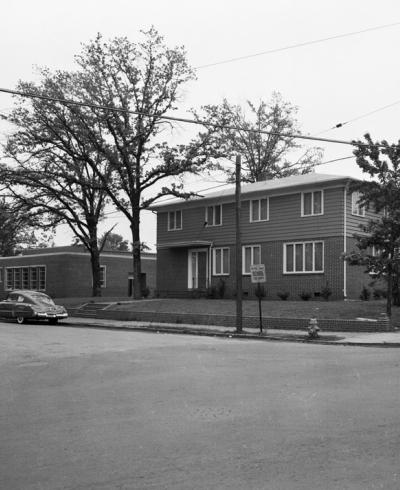
The central and west ends of the neighborhood were, in general, platted in the 1920s. James Gattis owned a large parcel of land in the center of the neighborhood (platted in 1884), bounded by Gattis Street and Burch Avenue and extending west to the intersection of Maplewood Avenue and north to S. A. Thaxton’s Line. This land, divided at the time into thirteen parcels, remained largely undeveloped until the 1920s. South of the Gattis lands and bounded by Burch Avenue, Gattis Street, Chapel Hill Street, and Maplewood Avenue is the property of Mrs. H. N. Snow, platted in 1923 and containing eighty parcels; Snow was born Anna Exum and was the first woman on the board of trustees at Trinity College (later Duke University). Her son, H. N. Snow, Jr. constructed his home in the district at the southwest corner of Gattis and Exum Streets. Finally, land in the northwest corner of the district, on both sides of the 1100 block of Burch Avenue, was owned by N. E. Ross and platted in 1921. The only houses at that end of the district at that time were the Ross House on the southwest corner of Maplewood and Burch Avenues and a second house (now gone) on the north side of Burch Avenue. South of the Ross lands, fronting on Duke University Road is the property of Norman Underwood. Underwood, a contractor, purchased the land in 1904 and erected his home facing Chapel Hill Street soon after. The land was sold as a single parcel to the University Housing Corporation in 1936 and the house was destroyed for the construction of the University Apartments.

The city of Durham experienced great growth in the first decades of the twentieth century. In 1900, the population of Durham was 6,679 residents, but by 1910, the town had grown to 18,241.8 Part of this increase in population was a result of the expansion of the city limits in 1901, an expansion that nearly quadrupled the area of the town. However, the success of the tobacco and textile industries as well as the growth of Trinity College, which came to Durham in 1892, fueled a migration from rural to urban areas. As a result, Anderson notes that, “in 1910 [there] emerged a new demographic picture of Durham County that signaled the end of an old era and the beginning of a new, marked by an urban majority.”

The growth of Durham as a city was very visible, with building construction taking place in all sectors of the town. In 1905 alone, 300 buildings were erected in Durham; yet initially residential construction was only a minor part of the construction, which was focused on industrial and commercial development. However, the availability of land in town (especially as a result of the expanded city limits), the swelling population, and developments in infrastructure, public services, and utilities lead to the construction of middle-class Durham neighborhoods outside of the central business district.

The proximity of the Burch Avenue neighborhood to the Trinity Park neighborhood to the northeast, the Morehead Hill neighborhood to the southeast, the campus of Trinity College to the north, and to the mostly undeveloped land to the west played a large part in its early growth. The arrival of Trinity College in 1892 was instrumental in the development of Durham west of downtown; the Burch Avenue neighborhood, located just south of the college, was directly impacted by its growth in the twentieth century. In 1924, with a large endowment from the Duke family, Trinity College formally changed its name to Duke University and began an expansion that would last more than ten years and culminate in a re-designed East Campus (just north of the district) and a newly constructed West Campus (immediately west of the district). Duke initially employed unionized workers from the North to perform the construction; however, they soon formed a construction company of their own that utilized local non-union labor, and likely employed some of the many construction-related tradesmen in the Burch Avenue neighborhood. In addition to the construction of the campus itself, lands around the school (especially around West Campus) were slowly developed as residential neighborhoods in the 1930s and 1940s.

During this same period, Durham enlarged its boundary once again, nearly tripling its area in 1924, making it the fourth largest city in the state. While the textile industry began to decline, the tobacco industry flourished through the mid-century. The reputation of Duke University nearby and North Carolina Central University (formerly the North Carolina College for Negroes 1923-1947 and then North Carolina College at Durham 1947-1969) south of downtown continued to bring both revenue and new residents to Durham throughout the twentieth century. During this period, existing neighborhoods expanded, new neighborhoods at the periphery of town were developed and building construction continued in earnest, largely due to the need for housing presented by the thousands of new residents. “The residential aspect of Durham’s built environment is perhaps the most tangible indication of the city’s prosperity during this twenty-year period.” The Burch Avenue neighborhood is no exception; the 1920s and 30s saw an explosion of building that filled-in the west end of the district from Gattis Street west to Swan Street.

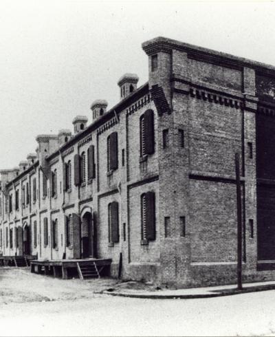
Burch Avenue’s proximity to lumber- and stone-yards on the west end of town, together with the abundance of small- to medium-scale housing (including rentals) in the neighborhood, certainly contributed to the large number of contractors, carpenters, and other building tradesmen who lived in the area. Established in 1894, the Cary Lumber Company, relocated in 1913 to a series of buildings on South Buchanan Boulevard, just north of the railroad tracks and east of the district in what was considered the 'edge of town'. The company built a sizable complex, including a mill and large dry kiln; by the 1930s, it had expanded its woodworking facilities even further. They remained in business through 1956 and in the late 1970s, the buildings, including a tobacco warehouse to the southeast, were acquired by Duke University.

In the early 1880s, Richard Fitzgerald established a brickyard on Kent Street (formerly Chapel Hill Road), just south of the Burch Avenue Historic District. Fitzgerald was raised as a free black man in Delaware, and he and his family moved to Durham via Philadephia in the early 1880s. By 1884, Fitzgerald was Durham’s leading brickmaker and had expanded his business into real estate and banking. While other family members lived in the African American community along Kent Street, around 1890, Fitzgerald and his family moved north of Chapel Hill Street to a large and impressively detailed house on the west end of Wilkerson, near Gattis. The large home, called ‘The Maples,’ was destroyed by fire sometime before 1924 when the land was subdivided.18 However, the land was never re-developed as housing and now, located just outside of the district, contains service buildings for Duke University. The Fitzgerald family had a hand in most of what came to define West End - including their brickyard along Kent St., the office building they constructed at the corner of Chapel Hill St. and Kent St., and the land they donated for St. Emmanuel AME Church.” While none of their homes or businesses are located within the district boundaries, they no doubt employed residents of the neighborhood in their brick-making and construction endeavors. Charles T. Fitzgerald (830 Wilkerson) may have been related to Richard Fitzgerald and was listed as a brick manufacturer in 1905. David A. Williamson (604 Gattis) was listed as a bricklayer in 1925.
.
Other nearby industry included the J. R. Clegg brickyard and the Durham Marble Works. J. R. Clegg was the son-in-law of Richard Fitzgerald and began his brickyard at the corner of Kent and Halley Streets in the 1910s. Located on the south side of Chapel Hill Street and just south of the district, the Durham Marble Works commenced business sometime before 1895. Operated by Robert I. Rogers, the Durham Marble Works made monuments and tombstones (for the nearby Maplewood Cemetery), brownstone and granite “trimmings and curbing,” and granite for porches and foundations. Rogers also ran businesses in Oxford and Henderson and was active in real estate in Durham as the treasurer of the Durham Land and Security Company. Like the nearby Cary Lumber Company, these businesses helped shape the demographic of the neighborhood. Dewey W. Lemons (909 Rome), F. J. Cody (916 Rome), and Moses P. Cole (920 Rome) were all listed as stone-cutters in the city directories.

As the town flourished in the early twentieth century, the demand for housing and other construction projects provided plenty of work for the myriad of contractors, carpenters, metal- and stone-workers, and other building professionals that populated the Burch Avenue neighborhood. Additionally, “as more and more Durhamites turned to architects for custom residential designs, the role of the building contractor, local building supply companies, builders’ manuals and the new magazines aimed at molding taste remained an active one.”

Several of the district’s most prominent residences were those of well-known contractors and carpenters in Durham. Albert Wilkerson was one of the first Durham building contractors in the area and resided on Wilkerson Avenue (named for him), as early as 1888. When his house was destroyed by fire, around 1907, Wilkerson erected the current structure at 508 S. Buchanan Boulevard. Wilkerson, who likely employed carpenters and tradesmen from the neighborhood, is known to have built Washington Duke's home Fairview and the Epworth Inn on the Trinity College campus.<

M. Webb Thompson, of the firm Thompson and Cannady, resided in the 800 block of Burch Avenue as early as 1919. However, by 1923 he had erected a two-story, Craftsman-style house at 1009 Burch Avenue. The house featured all of the latest trends and styles of the time, including banks of four- over-one Craftsman windows and a simple, square spindle frieze around the front porch. According to the Durham City-County Landmark application, the company used the home to showcase the workmanship and construction details that the firm could produce. Thompson and Cannady constructed a number of homes and duplexes in the area, including the early 1940s Colonial Revivial- style home at 1010 Burch Avenue, Thompson’s second residence. The house stands across the street from his earlier home and reflects the changing popularity of architectural styles in the neighborhood.

Other carpenters in the district, though not as well known as Wilkerson or Thompson, likely played a role in the construction of their own houses. Leonidas Sparrow was living at 410 S. Buchanan Boulevard in 1902, while erecting his home around the corner at 807 Wilkerson Avenue where he lived from 1905 into the 1940s. Similarly, Numa R. West was living on Wilkerson Avenue when his house at 502 S. Buchanan Boulevard was constructed c. 1907. The J. H. Davis House at 826 Exum Street displays elaborate exterior woodwork that was likely the product of its carpenter owner. Similarly, the exterior woodwork and trim detail present in the Wilson House at 904 Rome Avenue could be attributed to its earliest known resident, James T. Wilson, also a carpenter. R. L. Crumpacker, a carpenter and cabinetmaker, constructed his distinctive home on the northwest corner of Burch Avenue and Gattis Street c. 1913.

Generally, the Burch Avenue neighborhood was a middle-class neighborhood with a few prominent business owners but mostly blue- and white-collar workers. In contrast to the many building professionals in the district, other residents were more closely tied to burgeoning businesses in downtown Durham and were employed as clerks, bookkeepers, and salesmen. James J. Lawson (802 Burch Avenue) owned a grocery on Chapel Hill Street and Royal W. Smith (1620 Duke University Road) owned a furniture and home furnishings store also on Chapel Hill Street. Both men employed a number of neighborhood residents as clerks in their businesses. Additional occupations listed for early residents of the district include farmers, foremen, and a significant number of machinists and machine operators.

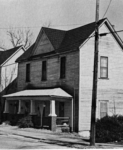
Compared to other middle- to working-class Durham neighborhoods, the district had relatively few tobacco- and textile-workers, though some of the small, frame, one-story houses on Rome Avenue (formerly Spring) and Exum Street (formerly Harwards Alley) may have been built by the tobacco companies or other private investors to house the lower-working-class. Rome Avenue, with its dead-end gravel road has a different, almost rural, feel compared with the rest of the neighborhood. The West End was always racially divided with white development in the center of the Burch Avenue neighborhood and blacks living at the northern fringes and south of Chapel Hill Street. The modest one-story houses along Rome Avenue are all that remains of an African American neighborhood, Brookstown, that extended along Rome Avenue (formerly Spring), Maxwell Street (formerly Ferrell), and S. Buchanan Boulevard (formerly Milton) on the northern fringe of the district. Brookstown was mostly destroyed in the 1970s, when the Durham Freeway (NC-147) was extended from Chapel Hill St. to Swift Avenue and the houses on Rome Avenue are now considered part of the Burch Avenue neighborhood.

The Burch Avenue neighborhood, like many of Durham’s historic neighborhoods, grew steadily through the 1940s; also, the district suffered the usual decline that plagued urban neighborhoods in the second half of the twentieth century. As families moved away from the inner city center, properties were purchased by real estate investors and in some cases, subdivided into multiple units. It was the construction of the Durham Freeway in the early 1970s, however, that brought the neighborhood into steep decline. The highway cut directly through the east end of the neighborhood severing its connection to downtown and eliminating scores of houses on Yates and Thaxton Avenues (the African American settlement of Brookstown) to the north as well as the 700 block of Wilkerson Avenue, the 600 block of Burch Avenue, and the 600 and 700 blocks of Chapel Hill Street to the east.

The construction of the Durham Freeway, together with the commercialization of properties along Chapel Hill Street have provided a clear boundary for the historic district, which is now oriented inward around Burch Avenue. The neighborhood continues to prosper due to its location and the variety of housing it offers. The district’s location between Duke’s East and West Campuses have made it a desirable neighborhood for University students and staff and its proximity to downtown Durham and to main transportation arteries (like NC-147) have made it equally attractive to those professionals working in downtown or elsewhere in the Triangle. Additionally, the availability of small- to mid-sized homes and the plethora of historic duplexes and rental properties have made the neighborhood attractive to young professionals, students, and growing families.