Support OpenDurham.org
Preserve Durham's History with a Donation to Open Durham Today!
OpenDurham.org is dedicated to preserving and sharing the rich history of our community. Run by our parent nonprofit, Preservation Durham, the site requires routine maintenance and upgrades. We do not ask for support often (and you can check the box to "hide this message" in the future), but today, we're asking you to chip in with a donation toward annual maintenance of the site. Your support allows us to maintain this valuable resource, expand our archives, and keep the history of Durham accessible to everyone.
Every contribution, big or small, makes a difference and makes you a member of Preservation Durham. Help us keep Durham's history alive for future generations.


Comments
Submitted by Phil (not verified) on Wed, 1/10/2007 - 3:42am
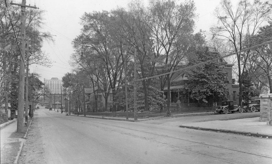
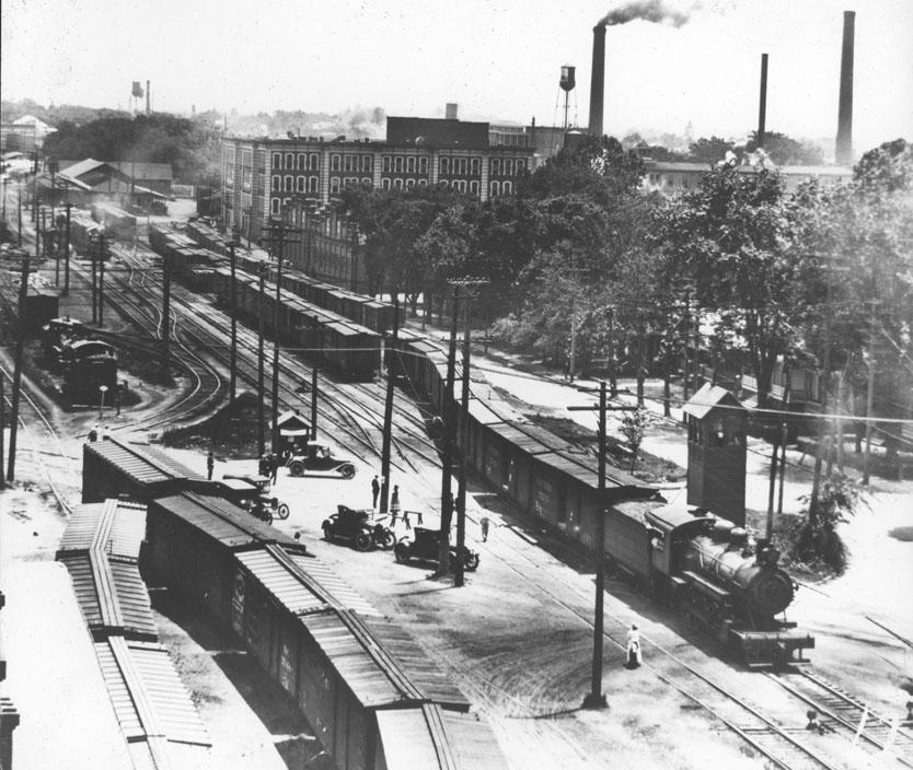
What a thing that would have been -- downtown Durham with all that traffic in trains, trolleys, cars, and feet.
I so wish I could time travel.
Submitted by Michael (not verified) on Thu, 1/11/2007 - 6:13am
Gary,
Do you happen to know anything about train trenches? I've gotten the idea in my head recently that downtown could solve an awful lot of problems -- objections from NCRR about TTA using their rails, the safety issues at Blackwell St., NCRR's refusal to put in pedestrian improvements at Broad/Swift, and in the long run, the big problem of where to put the high speed rail corridor, by lowering the tracks into a trench.
Reno is in the process of putting in their trench through downtown, at a total cost of around $285 million for a 2.3 mile trench, which is roughly $125 million/mile. Costs would vary greatly depending on soil type, utility crossings, the number of street crossings built, etc., but I think Durham would, at the low end, need 2-2.5 miles of trench to do just downtown proper and environs, and just over 4 miles to do my preference, which is Anderson to Alston. It's a huge chunk of money, of course, but I think it could defray some of the costs that have put TTA over a barrel, and with the high speed rail looming, there might be some federal funds there.
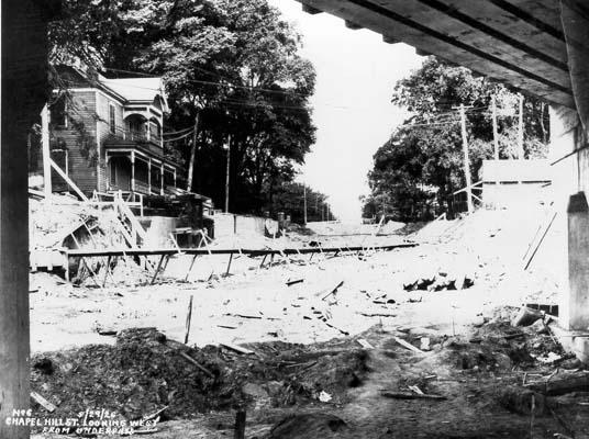
The only real intersections where trenching would cause complications would be Chapel Hill St., which this post makes me think isn't such a bad thing to reverse; Gregson St., which is kind of a mess there anyway; Erwin Rd., which is complicated just because putting the rail below grade would make one want to put the freeway below grade too, and that's a much bigger project (even if a good one); and Roxboro St., where even if the grade would work fine, you'd have to take out that beautiful old WPA crossing.
Submitted by Sven (not verified) on Thu, 1/11/2007 - 12:56pm
Michael
I know about as much as you've laid out here already - pictures of the Reno project, generally considered cost-prohibitive, etc. It would be really nice to have a separated rail corridor for the reasons you mention. I very much doubt that there would be Federal funds available unless David Price gets a lot more powerful and makes it his pet project or some such turn of events. FTA funds are just so limited, as we've seen with TTA already.
From an urban design perspective, I think it would require a good deal of thought about the overall impact. I doubt that if someone agreed to pay for this that they would be satisfied with our current single-track situation east and west of downtown. How wide would the trench need to be? What effect would that have on spots like Pops/Morgan Imports/Brightleaf? Could you 'cap' it at certain spots to maintain (or even improve) a streetscape at the current grade crossings? Would the topography actually better accommodate a combination of below-grade and above-grade? Etc.
Cool thought - thanks for sharing it. Unfortunately, instead of innovative thinking, we've got stuff like the Alston Ave. widening moving forward, evidently, so far, without the proposed improvements that the city and community have asked for to mitigate negative effects on pedestrians.
GK
Submitted by Anonymous (not verified) on Tue, 4/8/2008 - 5:56pm
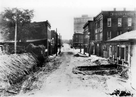
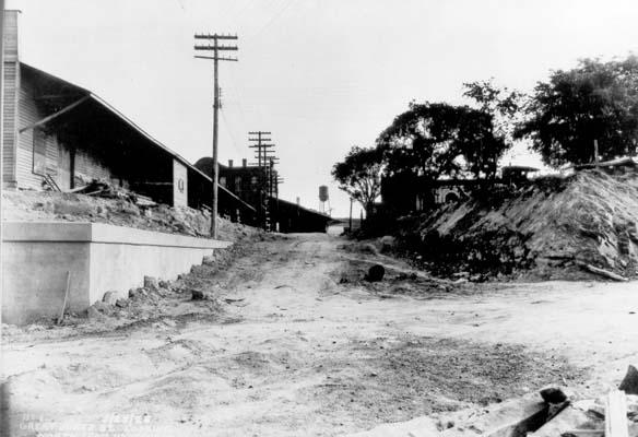
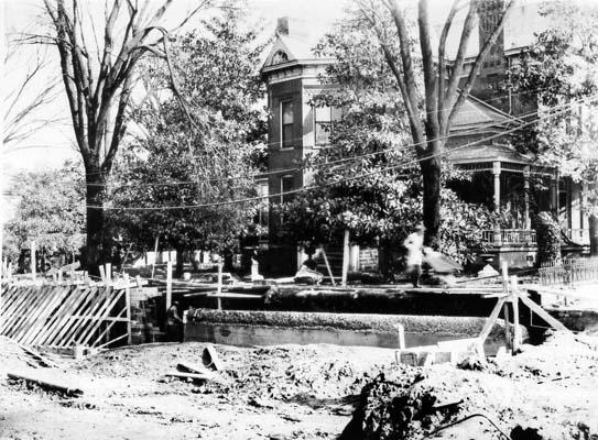
Your blog is fantastic and I apologize for commenting on old posts. Just wanted to help because I think you are correct about the last B&W picture being Campus Drive--the picture would be taken looking up the hill toward the east. The warehouse at the top right is the west end of the Smith Warehouse (114 S Buchanan). The foreground is where the East Campus steam plant and support buildings are now, surrounded by Maxwell St/Sumter St/Pettigrew. There are three underpasses on Campus Drive after the Durham Freeway going toward East Campus (to the left of this picture); this would be Pettigrew and out of the frame to the left would be the railroad and finally Main St.
Add new comment
Log in or register to post comments.