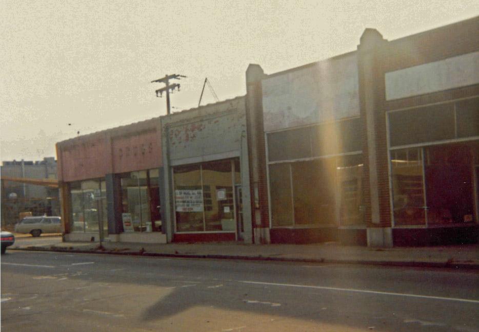
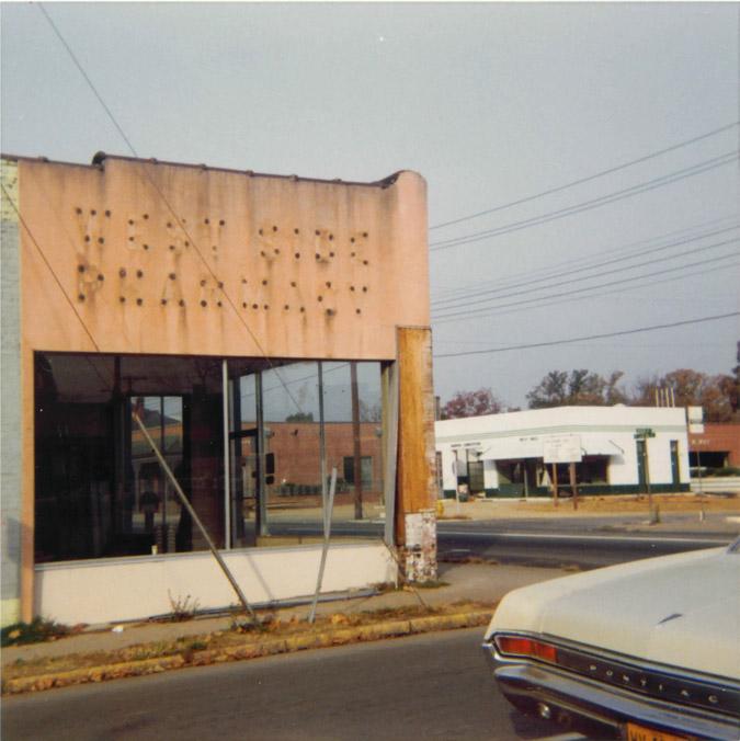
Empty West Side Pharmacy and adjacent commercial row buildings, looking southeast towards the corner of Vickers and West Chapel Hill St., November 1966. Only a small portion of 707-711 is visible to the right (with the Art Deco brick pilasters)
(Courtesy Milo Pyne)
As the West End developed along West Chapel Hill St., two commercial areas developed - one of the two was located at Vickers Avenue and West Chapel Hill St., the intersection between the main street of the West End and the main street of Morehead Hill. A set of early masonry structures was built here around 1910, probably replacing earlier frame structures. The remainder of the block, to the west, formed a residential buffer between the businesses and the 2nd Baptist (Temple Baptist) Church at Shepherd St.
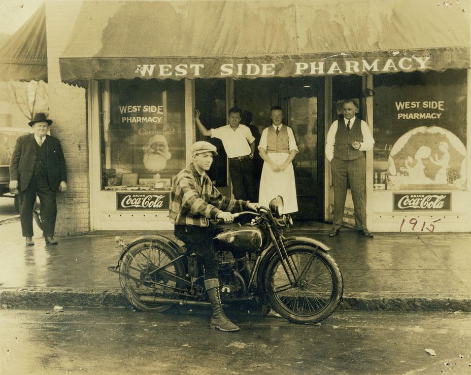
The West Side Pharmacy at 701 West Chapel Hill St. (the southwest corner of Vickers and West Chapel Hill.) Looking south, 1915.
(Courtesy Durham County Library)
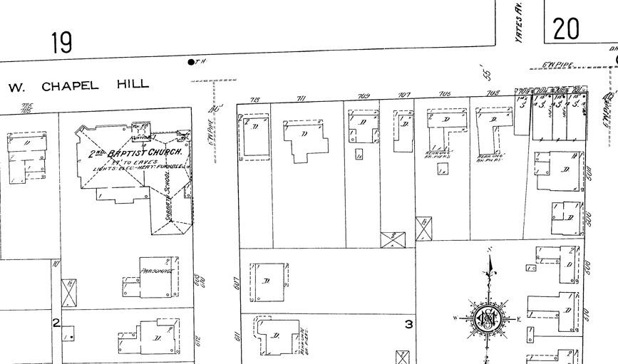
Sanborn Fire Insurance Map of the block from 1913 shows the commercial area and residential structures.
By mid-century, the remainder of this block had become commercial.
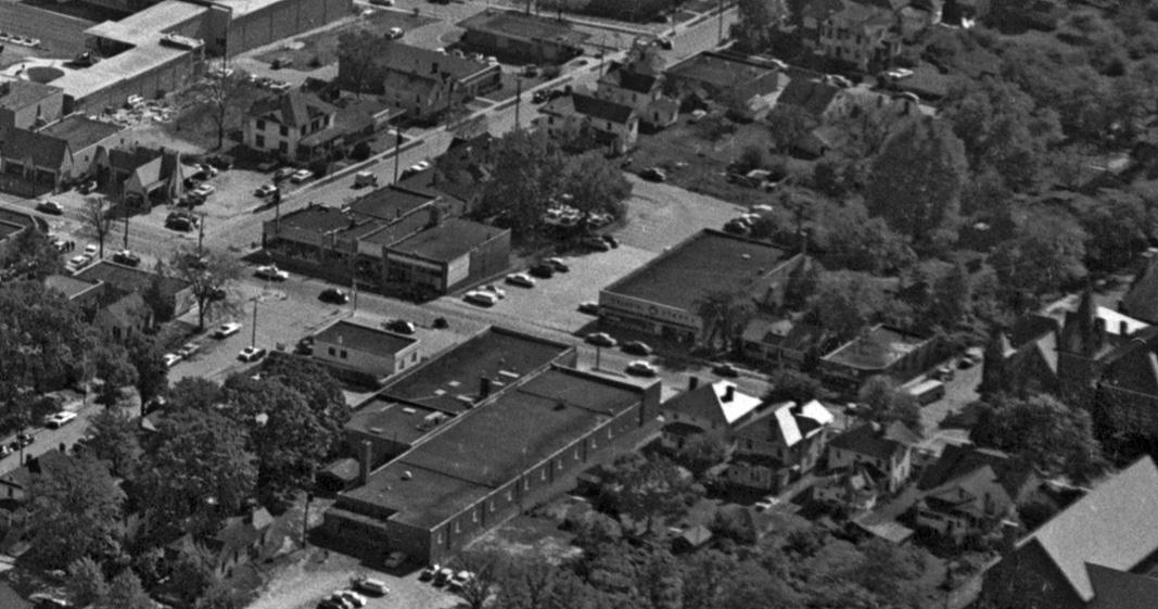
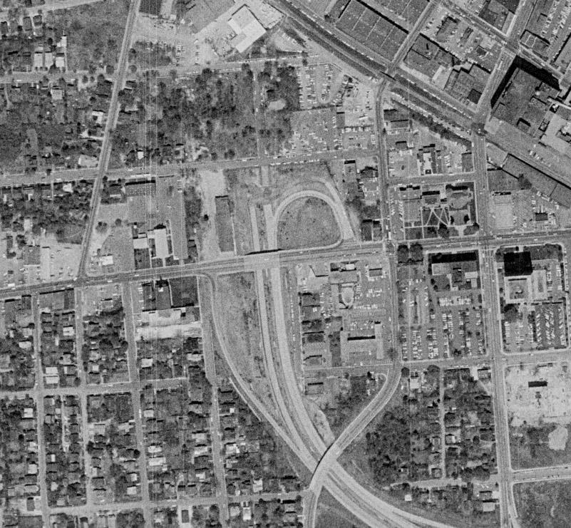
Aerial view of the 700 block of West Chapel Hill St., 1950s
(Courtesy The Herald-Sun)
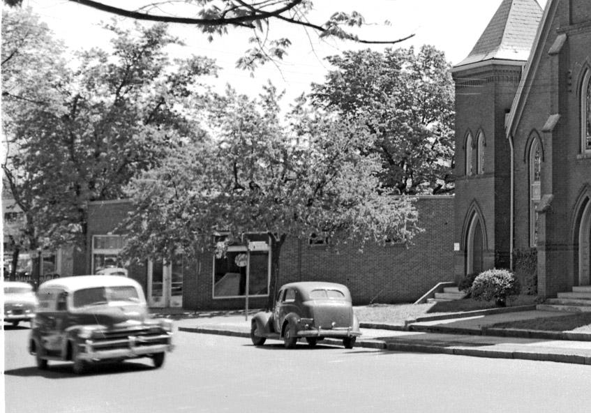
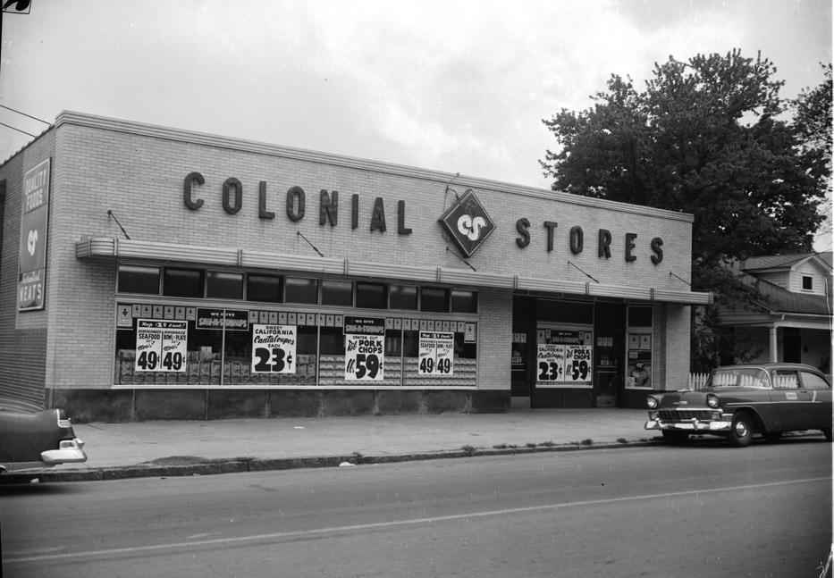
Looking southeast from West Chapel Hill St., past Temple Baptist, towards the southeast corner of Shepherd and West Chapel Hill Sts. - likely 1950s.
Colonial Stores supermarket in mid-block.
(Courtesy The Herald-Sun)
In 1967, the freeway would be plunged through this part of the neighborhood, removing this block.
Empty West Side Pharmacy and adjacent commercial row buildings, looking southeast towards the corner of Vickers and West Chapel Hill St., November 1966
(Courtesy Milo Pyne)
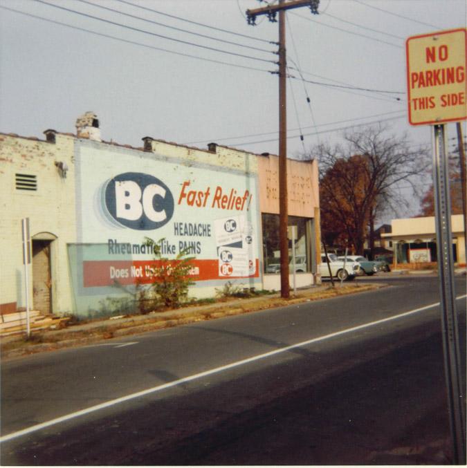
Side view of the empty West Side Pharmacy, looking northwest from Vickers towards West Chapel Hill St., November 1966
(Courtesy Milo Pyne)
Side view of the empty West Side Pharmacy, looking northwest from Vickers towards West Chapel Hill St., November 1966
(Courtesy Milo Pyne)
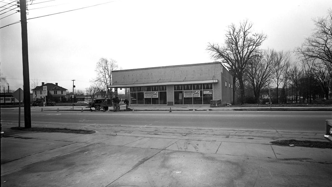
Looking south from the north side of the 700 block of West Chapel Hill, 01.05.67 - the former Colonial Stores supermarket - by this time a Brunson's store (Expressway Clearance Sale...) remains, while the structures on either side have been demolished.
The Freeway at its 1972 western terminus, West Chapel Hill St.
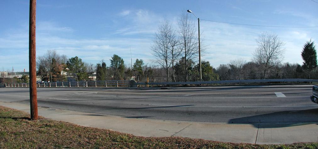
And the view of the south side of the 700 block, present day.
Looking south, 02.02.08
I profiled the West Chapel Hill St. bridge and just what a blight it is on the west side of town in December of 2006. Roads and interchanges don't have to be this bad, and I profiled what an innovative city did with their interchange to turn it into a streetscape - The Cap.
It seems that the Cap was a popular item at the West Chapel Hill St. charrette; unfortunately it never made it into the draft of the West Chapel Hill St. plan that I read, referred to only in allusory terms as grand and impractical - without a description of what that grand and impractical idea was.
This coincides with my general growing annoyance with the charrette model of community involvement, which has become ubiquitous. It seems like a great model for planners, or consultants to come in and be all cheerleader-y as they pose questions to the public and tell them to dream big, but in reality, it avoids dialogue. The public feels involved because they create and dream and get their ideas down on paper, but whoever facilitates these things takes the ideas back to the office and edits them down to what they feel is important - without ever saying in a meeting "well, that's a crappy idea - we're never going to do that." They thereby avoid confrontation. The dismissal of this idea - by demeaning it but not saying what it is - is one example. I felt similarly about the downtown master plan - how did the east side of downtown completely disappear from the 'focus areas' when it was a focus area on every single sheet displayed at the session I went to?
But back to West Chapel Hill St. - this bridge is a moat between the West End/Burch Avenue and downtown; once it was a part of the West End, in the middle of the neighborhood, and part of the trolley route connecting downtown with Lakewood Park down Kent St. It could be part of that connection again.
Add new comment
Log in or register to post comments.