Mirroring the early residential neighborhood on the east side of downtown (in the area of Ramseur, East Main, Liberty, Holloway, Queen, and Dillard Streets) was a residential neighborhood on the west side of downtown, centered in the area of Willard, Duke, Gregson, and West Chapel Hill Streets. While, like the east side, houses were intitially somewhat modest, by the late 1800s, these had begun to be supplanted by large Victorian structures (the earliest of which was the W.T. Blackwell house, built in 1875 at the site of the current Duke Memorial Methodist Church), particularly east of S. Buchanan Blvd. West of S. Buchanan Blvd. developed as a predominantly African-American Community, stretching south along the current Kent St. (Chapel Hill Rd.)
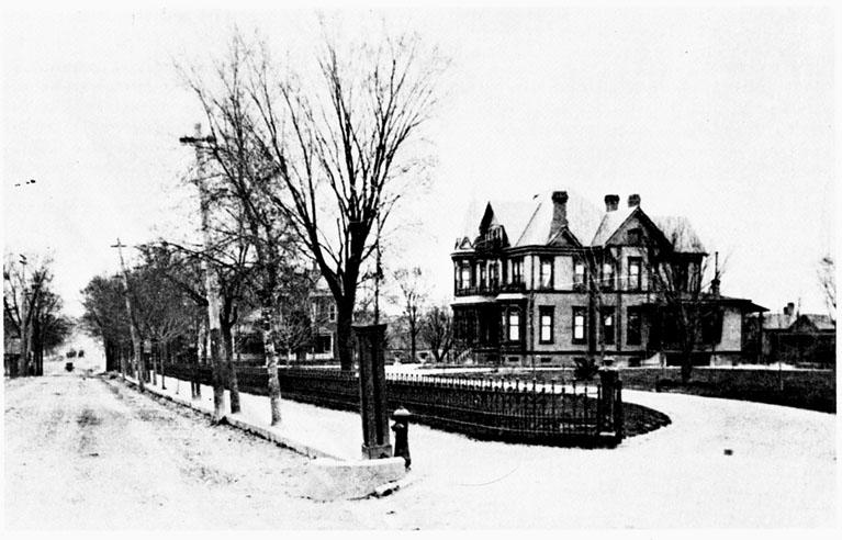
Looking east on West Chapel Hill Street from Duke Street, late 1890s. The prominent house in the picture is the first B.N. Duke Mansion at this location, called 'The Terrace'.
During the late 19th and early 20th century, the Morehead Hills neighborhood developed on the hill crest to the south (current Morehead Ave. and Duke Sts.) The neighborhood filled-in with rental housing, and commercial districts developed at Yates and Chapel Hill Street, S. Buchanan Blvd. and Chapel Hill St., and Kent St. and Morehead Ave. The first two were predominantly White commercial areas, the latter primarily African-American.
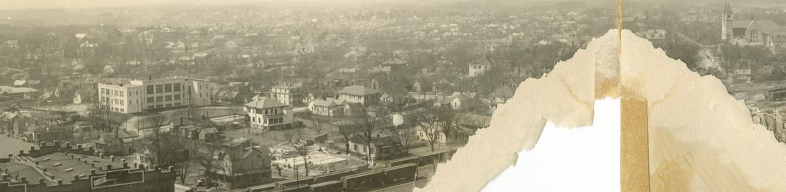
West End and Morehead Hill, early 20th century. This shot is probably taken from the roof of the Trust Building on Main Street, looking West/Southwest. The Duke Memorial Methodist church on West Chapel Hill Street is at the right extreme, and the American Tobacco warehouses are on the left extreme. The sizable institutional structure in the left portion of the picture is the old Morehead School.
(Courtesy Duke Archives)
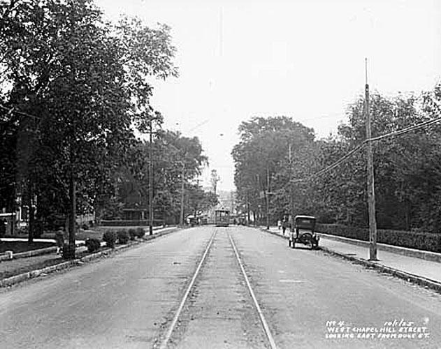
West Chapel Hill Street, looking east from Duke St., 1925. Large houses line the left side of the street; the second Duke mansion ('Four Acres') is behind the shrubbery on the right.
(Courtesy Durham County Library)
As with the east side neighborhood, transition began to occur in the 1950s, as commercial creep and demands for parking, coupled with decampment of the residents for places such as Forest Hills and Hope Valley, began to take their toll on the eastern portion of the neighborhood. Many houses were torn down for the construction of the Home Security Life Insurance Building (current police station) in 1957. Many more structures were demolished for the construction of the Holiday Inn in 1959 (current 'Urban Merchant Center'). The Duke Mansion was demolished in 1961.
An aerial view of the West End, 1959 - prior to the Durham Freeway. The Home Security Building (current police station) is visible, and the Holiday Inn is under construction.
The coup de grace for the eastern portion of the neighborhood came with the construction of the Durham Freeway in the late 1960s, combined with the Urban Renewal destruction of the remaining houses on the east side of Duke Street, (as well as on Willard Street, Jackson Street, Ashton Place, and the no longer extant Warren St.) This essentially shifted West End proper to the West, centered around the business district at S. Buchanan Blvd., and sharply demarcated Morehead Hills from downtown.
Today, there are very few structures that remain from the oldest portion of West End - north and east of the current path of the Durham Freeway. The result is somewhat of a no-man's-land between the current West End/Morehead Hill neighborhoods and central dowtown or American Tobacco. The 1970 Durham land use plan is instructive; it calls for (and I quote loosely from memory) - "replacement of the current inefficient single family homes with apartment block and office towers." The result, 26 years later, like much urban renewal land, is neither here-nor-there. The neighborhood is gone, but the Radiant City never materialized. Given what we now know about how neighborhoods and downtowns thrive, how does this 'West Downtown' neighborhood re-vitalize?
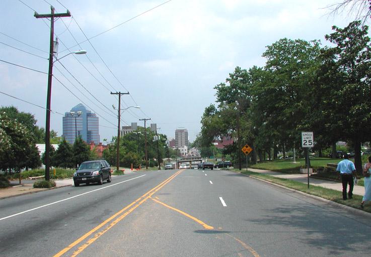
Look east on West Chapel Hill Street, from close to Duke Street, 2006
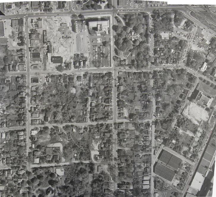
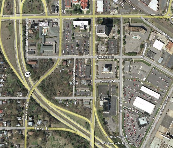
Aerial view of West End, encompassing same area as the 1959 aerial, approx 2003.
Add new comment
Log in or register to post comments.