Support OpenDurham.org
Preserve Durham's History with a Donation to Open Durham Today!
OpenDurham.org is dedicated to preserving and sharing the rich history of our community. Run by our parent nonprofit, Preservation Durham, the site requires routine maintenance and upgrades. We do not ask for support often (and you can check the box to "hide this message" in the future), but today, we're asking you to chip in with a donation toward annual maintenance of the site. Your support allows us to maintain this valuable resource, expand our archives, and keep the history of Durham accessible to everyone.
Every contribution, big or small, makes a difference and makes you a member of Preservation Durham. Help us keep Durham's history alive for future generations.
Comments
Submitted by Marsosudiro (not verified) on Wed, 1/14/2009 - 3:02pm
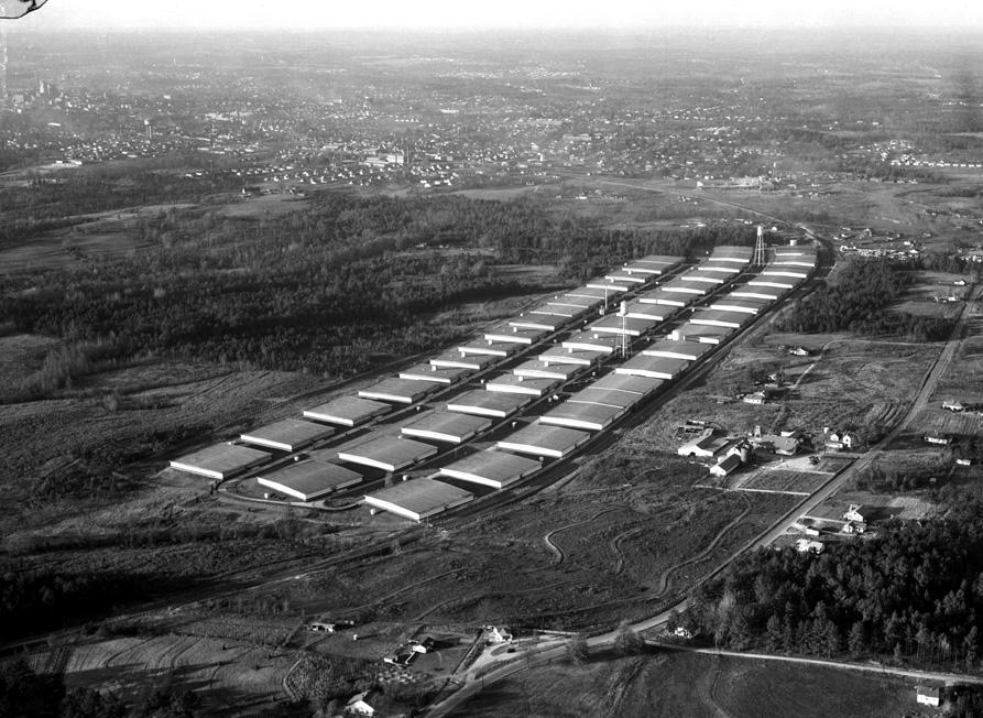
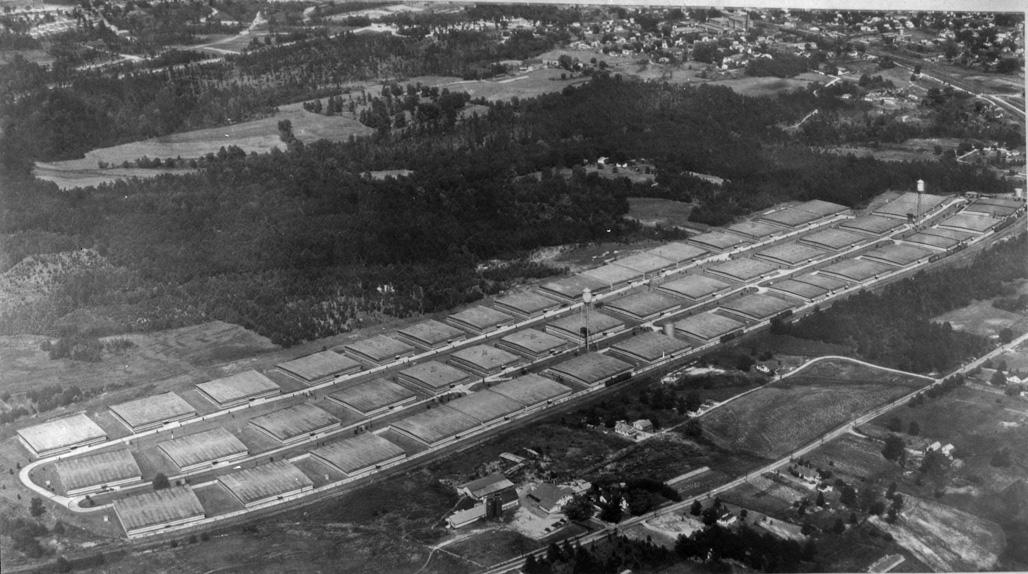
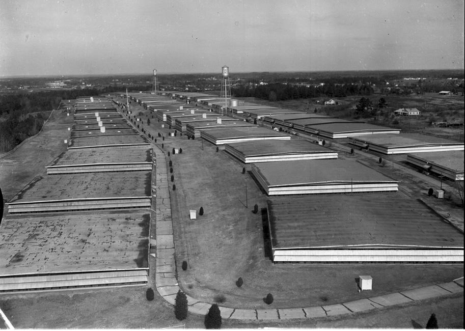
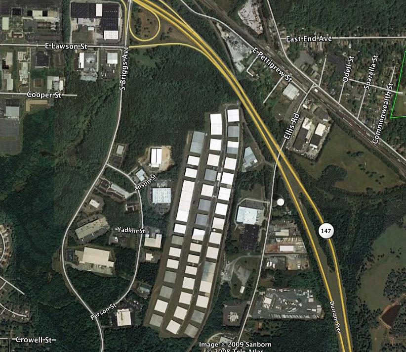
By coincidence, I just noticed these on Google Earth for the first time ever, last week. WTF-hugeness?! I thought.
Any more info on who the un-named LLC?
Submitted by Anonymous (not verified) on Thu, 1/15/2009 - 3:24am
Saw they were building a road to connect on Briggs Road. Heard that several high profile Durham/national businesses are using the buildings for storage.
Submitted by Billie (not verified) on Thu, 1/15/2009 - 6:51pm
My grandfather was a night watchman at these warehouses. After WWII, he lost his job at one of the mills because he was not a US citizen and was considered to be an alien from England. I remember going with my mother to take him to work.
Submitted by Jeremy T (not verified) on Fri, 1/16/2009 - 2:08pm
You can see a glimpse of these things when heading south on the Durham Freeway. I had no idea just how far back they extended though.
What are they used for now? There are several vehicles back there visible on google maps.
Submitted by Anonymous (not verified) on Fri, 3/13/2009 - 9:47pm
The pictures are a real treat to me. I grew up on Ellis Road across from the warehouses. Back then I could see the outline of the city of Durham from the front yard. Hear the old trains on the railroad tracks next to the ware houses. etc.
Submitted by Lonnie (not verified) on Fri, 3/13/2009 - 9:49pm
Any photo showing area on the right of ellis road?
Add new comment
Log in or register to post comments.