Support OpenDurham.org
Preserve Durham's History with a Donation to Open Durham Today!
OpenDurham.org is dedicated to preserving and sharing the rich history of our community. Run by our parent nonprofit, Preservation Durham, the site requires routine maintenance and upgrades. We do not ask for support often (and you can check the box to "hide this message" in the future), but today, we're asking you to chip in with a donation toward annual maintenance of the site. Your support allows us to maintain this valuable resource, expand our archives, and keep the history of Durham accessible to everyone.
Every contribution, big or small, makes a difference and makes you a member of Preservation Durham. Help us keep Durham's history alive for future generations.
Comments
Submitted by John Goebel on Tue, 9/6/2016 - 3:00pm
Submitted by John Goebel on Tue, 9/6/2016 - 3:05pm
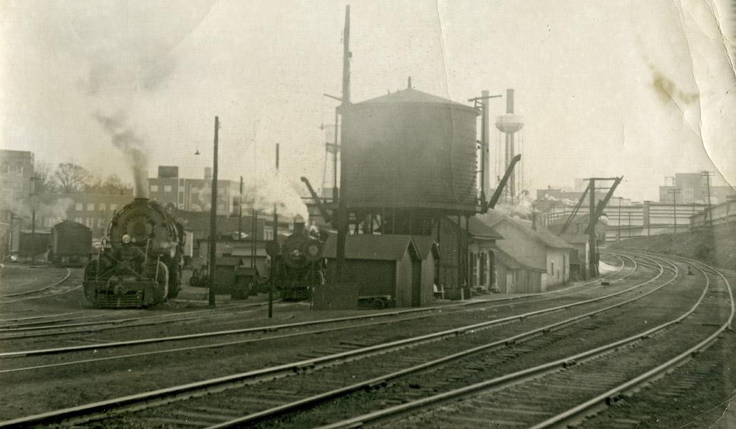
The above photograph is from the exact same location as the top picture in this post. As you can see in the old photo, there were three main lines running through this area. There is an addition side track to the right (east) of the one in this photo. It ran back north to the Erwin or Pearl Cotton Mill. To the left of the three main lines was the water tower and repair yard for the trails. Some of the old ties and rails are scattered about in this space. This area is just behind the existing Blue Note Grill and the red truck in the background belongs to Erwin Oil.
Add new comment
Log in or register to post comments.