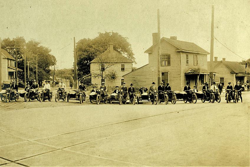
Looking north at the intersection of N. Mangum St. and Rigsbee Ave. and SE Rochelle's motorcycle club, ~1910.
(Courtesy Durham County Library)
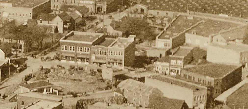
The northeast portion of what we now consider 'downtown' was a primarily residential area well into the early 20th century, gradually supplanted by commercial structures during the 1920s and onward.
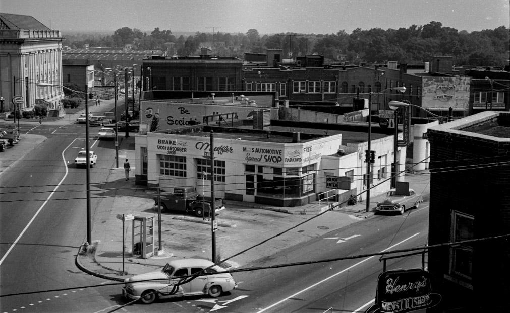
Above, an aerial view of the E. Chapel Hill St, Rigsbee Ave, N. Mangum 'triangle' in 1924. Many of the houses in the first picture have been demolished (although the house at the left edge of the frame in the first picture is still visible at the left edge of the above picture) and supplanted by commericial buildings and gas stations. The first iteration of a service station at Rigsbee and North Mangum is visible to the left - the 'awning' type structure typical of the 1920s, facing the corner.
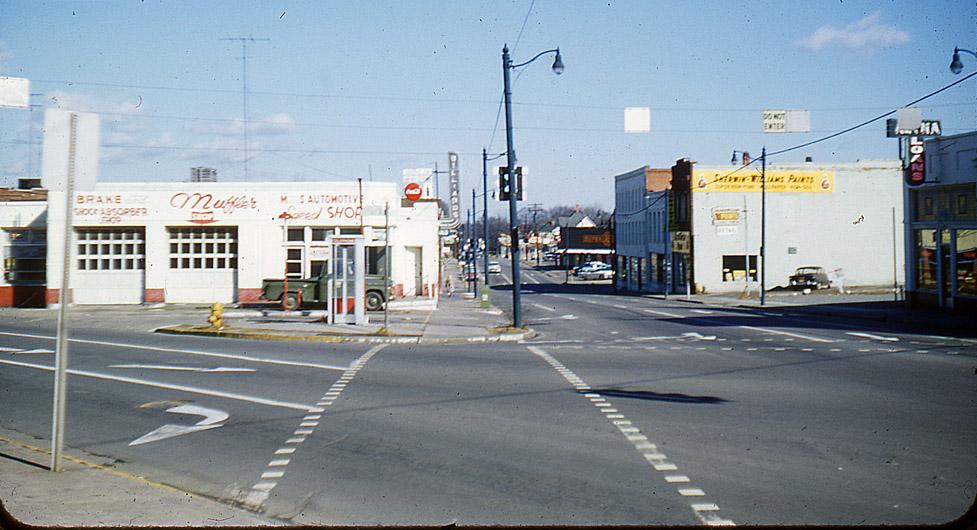
This station was replaced with a more modern structure, backing up to the bus station, by the 1940s. By the late 1950s, the station was a muffler repair shop.
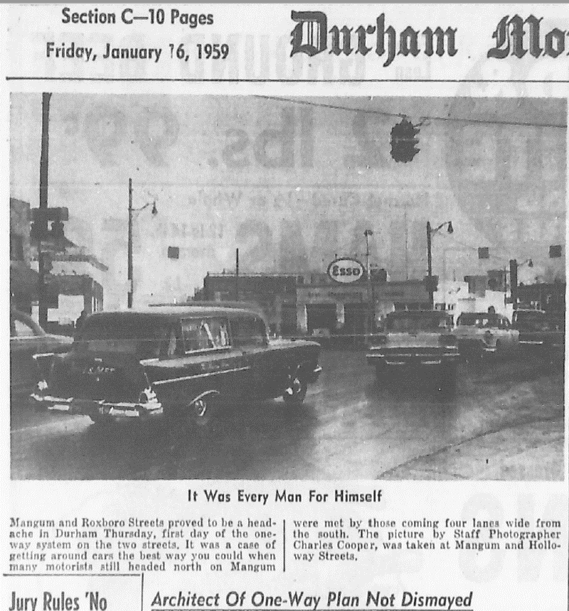
Comedy ensued when Mangum and Roxboro Streets were converted to one-way traffic in January 1959. The front page of the local section featured a photograph of a mass of cars heading north - now the wrong way - on Mangum Street. Note the confidence of the plan designer: "Architect Of One-Way Plan Not Dismayed". The Esso station is visible in the background (scan of the January 16, 1959 Morning Herald newspaper).
Looking north from Rigsbee and N. Mangum - the service station is in the foreground, followed (along Mangum) by the old bus station and another service station - 06.07.61
(Courtesy Herald-Sun)
Looking north from Rigsbee and Mangum, 1961.
(Courtesy Duke Archives)
In 1961, these buildings were demolished by the city for surface parking (prior to the urban renewal program.)
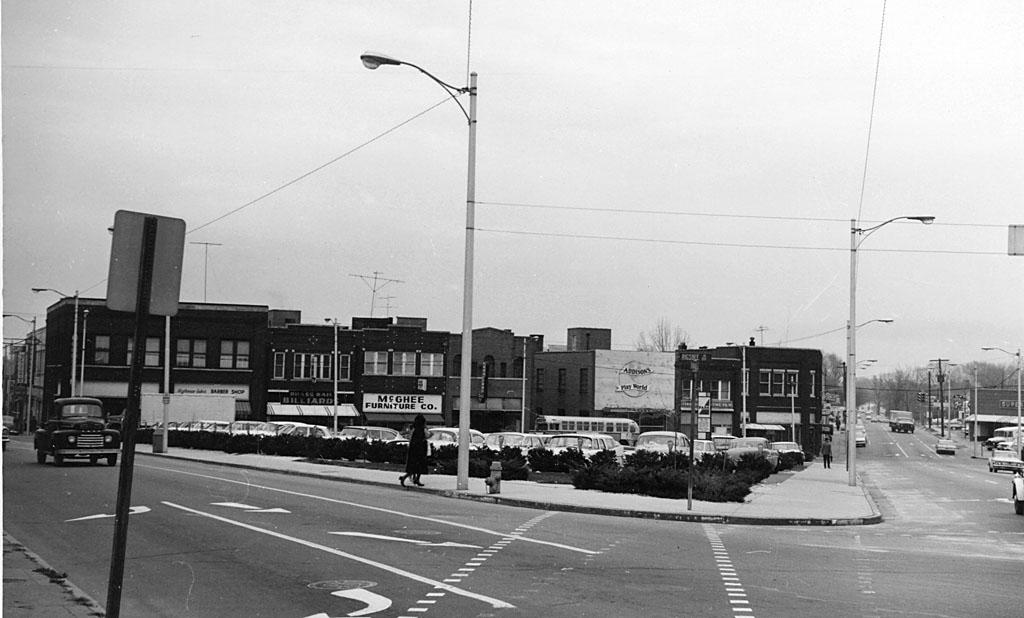
Looking southwest from North Mangum and East Chapel Hill, 1961.
Looking north from Rigsbee and Mangum, 1961.
(Courtesy Durham County Library)
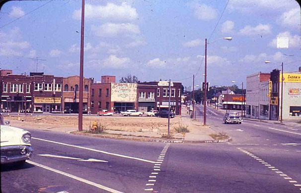
The completed parking lot, 1963.
(Courtesy Durham County Library)
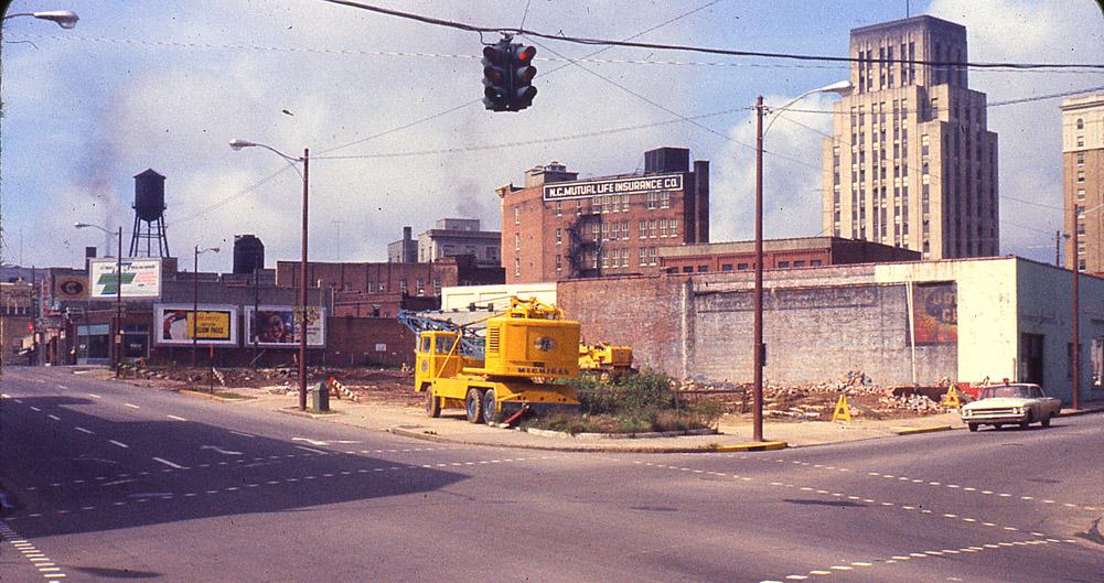
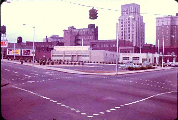
Looking southwest from East Chapel Hill and North Mangum, 1970.
(Courtesy Durham County Library)
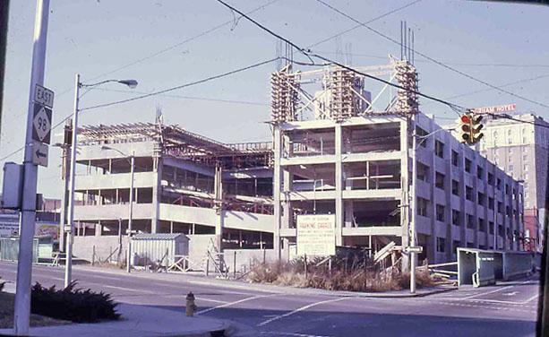
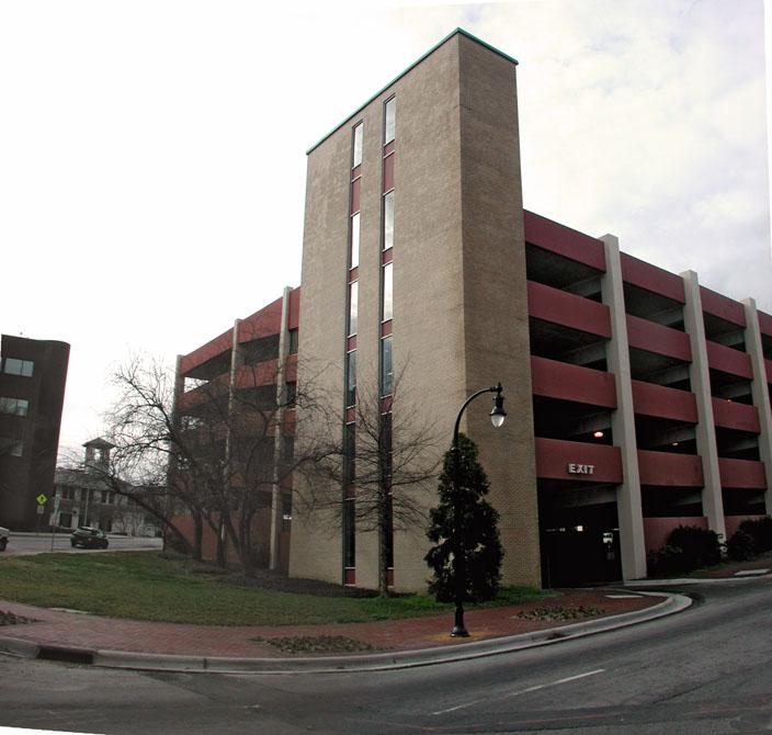
In the late 1960s, Durham closed the one block section of Rigsbee that ran between East Chapel Hill St. and North Mangum St., after having taken the buildings on the west side of Rigsbee via urban renewal. With the new, large parcel, they began construction of a new parking structure.
Looking southwest from East Chapel Hill and North Mangum, 1970.
(Courtesy Durham County Library)
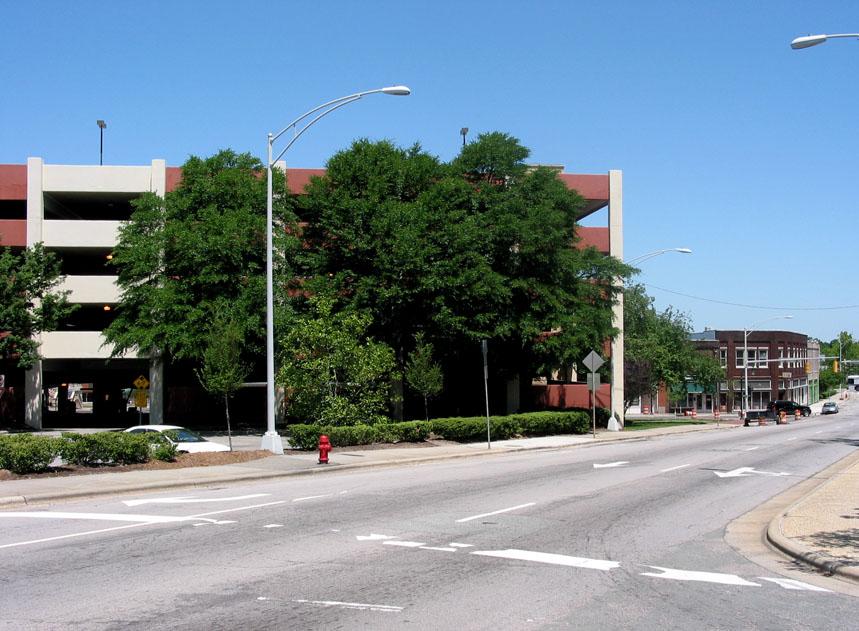
This behemoth is still with us, albeit with bright reddish accents
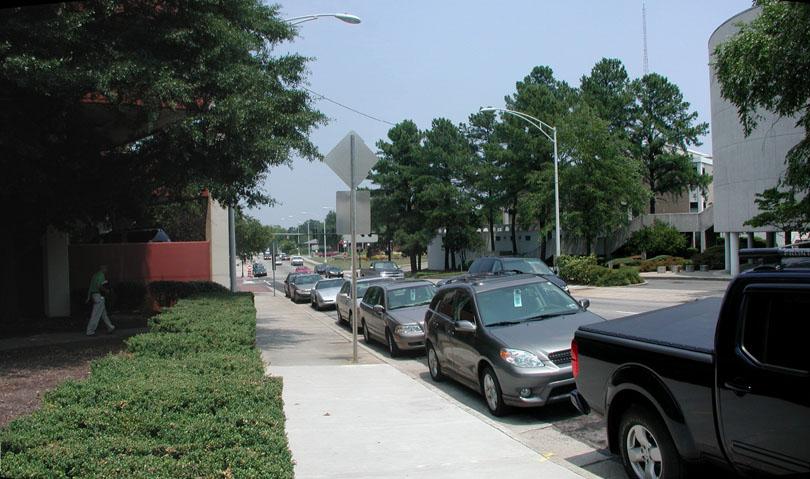
Looking north from the former intersection of Rigsbee and North Mangum, 2007 - the approximate location of the 307 N. Mangum service station.
Looking east at the former site of the bus station, 2007
Looking north up North Mangum along the east side of the former bus station.
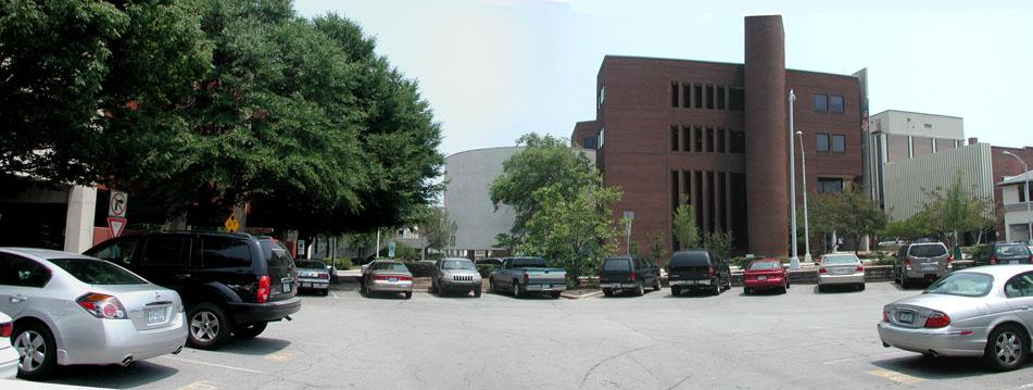
Looking southwest from East Chapel Hill St. and North Mangum.
While I've hit a pretty constant drumbeat on the need for first floor retail or liner buildings to mitigate or eliminate the deadening effect that parking garages have on the streetscape, this one just needs to go away. The space here - with some great architecture around it - on East Chapel Hill, Orange, Parrish, and Mangum/Main (everything, essentially, except City Hall) is too valuable to be blotted out by a parking garage. This is a central space, and whether it contained public space or public space + new development, it should not be wasted on parking (particularly parking which obliterates the view of the post office, Rue Cler, etc.)
Add new comment
Log in or register to post comments.