614 Carr Street / 500-600 Blocks Carr St.

35.991835, -78.906829

Year built
1870-1910
Year demolished
1967
Construction type
Neighborhood
Building Type
Can you help?
You don't need to know everything, but do you know the architect?
Log in or register and you can edit this.


Looking southwest, 1880s
(Courtesy Herald-Sun)

The 500 and 600 blocks of Carr, situated directly across Carr St. from the American Tobacco warehouses, were the early location of company housing - what we'd call 'mill housing' were this a mill; small detached houses with yards that catered to company employees.


A view looking east across the tops of these houses, 1920s.
(Courtesy Duke Archives / Digital Durham)

Below, a view looking north up Carr St. from Morehead Avenue.


(Courtesy Robby Delius)

The picture below gives the best sense of the relative uniformity and quantity of these houses - although it a is broader shot, showing Carr St., Willard coming it at an angle to meet Warren St. and Portland Ave - the short east-west street that intersected Carr and formed the division between the 500 and 600 blocks.


(Courtesy Herald-Sun)

This picture also shows how Morehead Ave., at the right edge of the picture, initially ran by the south end of American Tobacco, along the path of current-day Jackie Robinson, before terminating one block east of the complex.

The storyline here is slightly different than usual, in that the pressure of car commuters took their toll on these houses before urban renewal did.


Looking northeast, 1950s.
(Courtesy Herald-Sun)

Most of these houses were torn down during the late 1950s/early 1960s for surface parking for American Tobacco, leaving only a few structures.


512-528 Carr St., looking northwest, 1965.
(Courtesy Durham County Library)


600-608 Carr St., looking south, 1965.
(Courtesy Durham County Library)


614 Carr - one of the small houses that persisted, near the corner of Carr and Morehead, 1965.
(Courtesy Durham County Library)

The remainder of these were torn down by urban renewal.


Looking east-southeast, 1968.

All of the parcels, with many others to the west, were combined into a big parcel and sold off to the Alexander Ford Motor Co., which had moved from its previous location on East Main Street, in 1972.


Looking north-northwest, 1972.
(Courtesy Herald-Sun)

This later became University Ford, which it remains today.


Looking northwest from Carr and Jackie Robinson, 02.10.08.

This remains among the lowest and least appealing potential uses of this land. I do hope this car dealership will go live with its friends out at Southpoint sometime soon, and that it will be redeveloped into a dense mix of uses, as it originally was. Rumors have abounded about the quantity of cash University Ford wants in order to go elsewhere. While I'm sure they want to maximize their profit, I hope they take something reasonable at some point - I think it's crucial to creating the connectivity with the southwest neighborhoods that will help both those neighborhoods and downtown thrive.

Comments

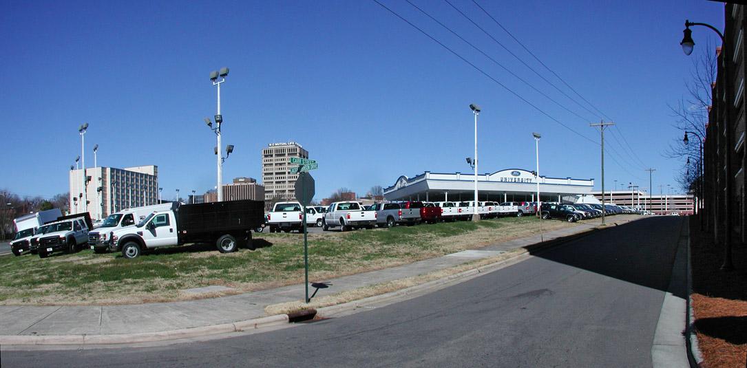
Totally agreed on the car dealership - the chainlink fence especially makes this block very unwelcoming. It doesn't help that the "live like a king for $145k" motel-condo facility is right across the road from it, either - the area directly west of the ATC is really quite unpleasant.

Maybe the economic uncertainty will prompt them to sell to avoid a future loss in value.

Add new comment

Log in or register to post comments.